
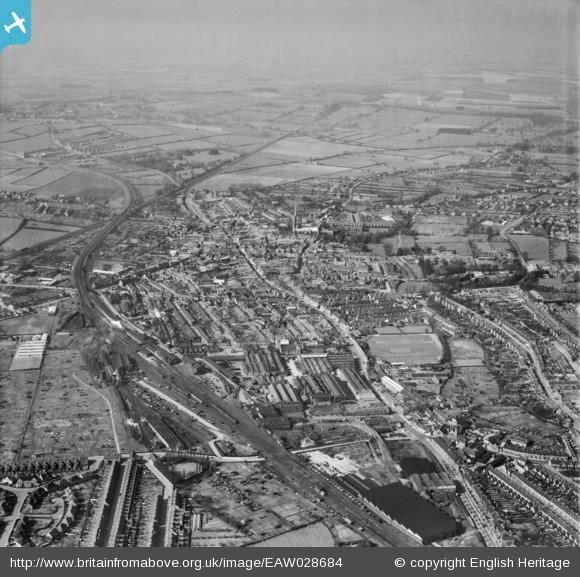
The Britain From Above project is publishing the Aerofilms archive. Here are five photographs which show the railway in and around Grantham. They were taken consecutively on Wednesday 19th April 1950. Left click on a photograph to follow a link to Britain From Above, and register on the site to zoom in and see much more detail.
_________________________________________________________________________
Left click the image to view it on Britain from Above; log in or register there to zoom in.
Left click the image to view it on Britain from Above; log in or register there to zoom in.

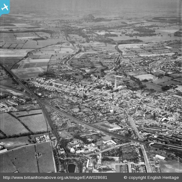
From the angle of the sun it is estimated that the these photographs were taken at about 3.40pm (British Summer Time being in force). At platform 4 is the 3.50pm to Lincoln, and at platform 5, the western platform, stands the 3.55pm to Derby.
Left click the image to view it on Britain from Above; log in or register there to zoom in.
In 1962 the A1 bypass was opened, a mile to the left of this view.
Between the railway and the A1 road, for the lower third of the photograph, is the extensive engineering works of Ruston & Hornsby Ltd.
Left click the image to view it on Britain from Above; log in or register there to zoom in.

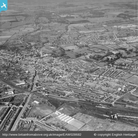
The only parts of Grantham's railway layout not in view are the internal system of Aveling Barford's, just off the picture at bottom right, and the end of the siding from Ambergate Yard to the gas works at centre left.
Left click the image to view it on Britain from Above; log in or register there to zoom in.
_________________________________________________________________________
The four following photographs were also taken on 19th April 1950. The subject was the R.H. Neal & Co. Ltd. crane factory on Dysart Road. Fortunately, for those of us interested in Grantham's railway history, very close by was Ambergate Yard, the site of Grantham's first railway station of 1850. So, happily, these views also capture the entire length of this rarely photographed short branch line and its sidings, still serving the town's oldest industrial quarter around the terminus of the Grantham Canal opened in 1797.
Much of the detail described in the captions of these photographs is in the background; to see it more clearly register on the Britain From Above website and use the zoom facility.

Left click the image to view it on Britain from Above; log in or register there to zoom in.

Left click the image to view it on Britain from Above; log in or register there to zoom in.
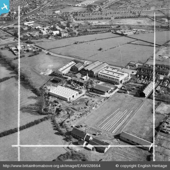
There are two oil tank wagons at the end of a siding towards the right.
A siding on the far side of the canal basin leads towards the gas works, just off picture to the right.
At top left there's a glimpse of the station platforms, with a northbound main line train at platform 3 and local trains at platforms 4 and 5.
Left click the image to view it on Britain from Above; log in or register there to zoom in.

Left click the image to view it on Britain from Above; log in or register there to zoom in.
Copyright note: the article above is published with the appropriate permissions. For information about copyright of the content of Tracks through Grantham please read our Copyright page.
The mention of Bjorlow's Tannery brings back the memory of the terrible smell that occasionally drifted from there, if the wind was blowing from that direction, as we used to walk up Dysart Road. Of course the bridge mentioned in the comment is now Earlesfield Lane, which leads to the 'New' Earlesfield Estate.
Hello Ian,
I'm not a native of Grantham but I like to 'explore' so, with a few minutes to spare during a visit the other week, I found myself driving on Earlesfield Lane and crossing the canal. I turned round, came back and looked out for the waterway again in the opposite direction - but it seemed to have disappeared! Only later did I realise that on the town side of where that bridge used to be the canal has been filled in, and there's just grass.
John Clayson